言語の変更
  • eurbaa
  • Český
  • Deutsch
  • English
  • Español
  • Suomalainen
  • Français
  • עִברִית
  • हिंदी
  • Indonesia
  • Italiano
  • 日本語
  • 한국어
  • Nederlands
  • Norsk
  • Polski
  • Português
  • Romana
  • Русский
  • Svenska
  • Türkçe
  • 中文
  • ホーム
  • ベクトル
    • アーキテクチャ
    • オブジェクト
    • シンボルや記号
    • トラフィック
    • ビジネス
    • フラグ
    • フード&ドリンク
    • 人物
    • 動物
    • 背景
    • 自然
  • パブリックドメイン
  • SVG generator
  • SVG Editor

東アジアの状態

東アジアの状態
Twitter FB Pinterest

Sponsored results by Shutterstock
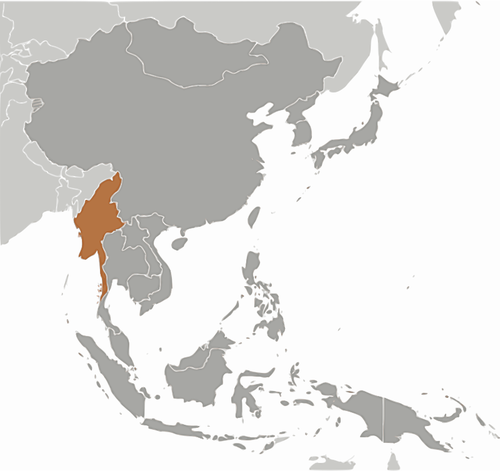
Europe with a part of the Middle East countries, political map. Western part of continent Eurasia, located in the Northern Hemisphere. Countries with international borders and English labeling. Vector
Middle East, political map countries with capitals and international borders
Africa, single countries, gray political map. Largest continent, including Madagascar. With English country names and international borders. Isolated illustration on white background. Vector.
Russia and Ukraine map on world map. The borders of Russia and Ukraine are colored. It looks different from other countries. Representation of limits on the possibility of war.
China flag, official colors and proportion correctly. National China flag. Vector illustration. EPS10.
Eastern Roman Empire. European Hun state. Western Roman Empire.
South Korea, India, China, Taiwan, Japan, Bangladesh, Malaysia, Thailand Philippines flag vector illustration. Asian states national symbols set with countries names. Asia rounded official flags icons
Decorative eastern design elements. Paper cut mandala flower and seamless pattern. Ornament in asian style. Islamic floral decor and template print for wallpaper, card. Elegant dark blue, white color
Flags of Middle East countries in round shapes, including Saudi Arabia, UAE, Qatar, Kuwait, Oman, Bahrain, Iraq, Iran, Jordan, Lebanon, Israel, Turkey, and others. Vector illustration.
ダウンロード

説明

アジアのビルマの地図。

カテゴリー

オブジェクト,シンボルや記号

ライセンス

?????????

スペック

0.59 MB

2017-12-02

658

ソース

Openclipart

タグ

地理学 場所 svg 灰色 灰色 ビルマ 東 アジア大陸 状態のシルエット

タグ

地理学 場所 svg 灰色 灰色 ビルマ 東 アジア大陸 状態のシルエット

関連検索

関連の無料ベクトル

オハイオ州の旗ベクトル イラスト
カリフォルニア州のベクトル フラグ
ノースカロライナのベクトル フラグ
サウスカロライナのベクトル フラグ
ソ連ベクトル クリップ アートの状態の品質マーク
ベクトル グラフィックスをイギリスの旗
ジョージア カントリー フラグ ベクトル
セイシェルの旗を振っています。
パレスチナの旗ベクトル クリップ アート
別の感情的な状態の子供の漫画のアイコンのベクター クリップ アート
イエメンのベクトル フラグ
LED ディスプレイによる高速道路標識のベクトル画像
韓国の波状の旗
ネパールの国旗
ラオスの波状の旗
中国の国旗
東ティモールの波状の旗
半島マレーシアの白地図

リンク

  • 我々について
  • パブリックドメイン
  • コンタクト

便利なツール

  • Free Unzip Tool
  • Inkscape
  • Illustrator
  • CorelDRAW
  • Openclipart
  • 123freevectors
  • Free backgrounds
  • Free SVG

我々について

Publicdomainvectors.orgは、ポピュラーなEPS、SVG、Ai、CDRフォーマットで、著作権フリーのベクターイメージを提供しています。法律の下で、このサイト上のアップローダーはベクトル画像すべての著作権を放棄しています。許可なく、無制限に商業目的に画像を編集したり配布したり、使用できます。絶対的に必要ではありませんがが、我々のウェブサイトを勧めていただけると嬉しいです。

カテゴリー

  • アーキテクチャ
  • オブジェクト
  • シンボルや記号
  • トラフィック
  • ビジネス
  • フラグ
  • フード&ドリンク
  • 人物
  • 動物
  • 背景
  • 自然
social-media FB Instagram Tumblr deviantart LinkedIn Twitter Pinterest Youtube

2013-2025 Publicdomainvectors.org